Best Apps to Plan Light for Photography: Compared
 by Marco Carotenuto · · 8 min read
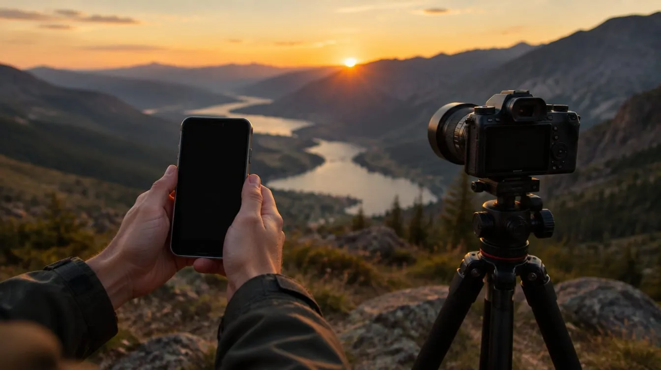
Search for an app to plan light and you get lists of ten names, nearly all described in the same words: “precise”, “comprehensive”, “essential”. The catch is that an app for photographing a sunset over flat ground and one for lining up the Milky Way solve different problems, and paying for every feature when you need one is a good way to end up with an app you never open.
This comparison starts from what you have to decide before you leave: which direction the sun comes from, at what time, and whether something stands in its way. You get a table of the main tools, a second one by need, a common mistake (sunset time is not the time the sun disappears behind your mountain) and a 20-minute test. If you want the bigger picture of a whole outing first, read how to plan a photography trip.
One honest note up front: we haven’t run lab tests or measured how accurate each app is. We rely on the makers’ own pages and one independent guide, listed at the end. Prices and features change often, so check the store before you pay.
What does a light-planning app need to do?
It needs to answer two questions: where will the sun be, and when. Everything else is a bonus. The features you find on the tools’ pages boil down to five:
| Feature | What it’s for | When you really use it |
|---|---|---|
| Sun direction on a map | See which side the light comes from and where shadows fall | Always, it’s the core of the tool |
| Light times | Sunrise, sunset, twilights, golden and blue hour for your place and date | To decide when to arrive |
| 3D terrain or augmented reality | See whether mountains or buildings block the sun | For landscapes with relief and for scouting |
| Saved plans and places, Moon and Milky Way | Build a list of shots to chase | If you plan night shots and rare alignments |
| Weather | Know whether clouds will show up | Always, but in the pages we read it isn’t the central feature |
That last row is a warning: these apps calculate where the sun will be, not whether clouds will cover it. An Italian landscape-photography guide, Trekking Fotografici, suggests a separate weather app for models and radar. If you first need the groundwork on direction and quality of light, start with how to read light in photography.
Which apps are the main options, compared?
Four tools cover most needs. The details come from the official pages and, where marked, from the Shotkit guide.
| Tool | Where you use it | What sets it apart | Cost according to the sources |
|---|---|---|---|
| SunCalc | Browser | The sun’s path on a map, sunrise, sunset and twilight times, shadow length for an object of chosen height, reverse calculation from altitude and azimuth | Free, with an optional donation |
| The Photographer’s Ephemeris | Web, iOS | Sunrise and sunset direction on the map, a timeline with golden hour and twilights, 3D maps and augmented reality (the latter on iOS) | Web with a free start; Shotkit lists the App Store version at $9.99 with in-app purchases |
| PhotoPills | iOS, Android | Map planner, augmented reality for Sun, Moon and Milky Way, saved places and plans, exposure, depth-of-field and time-lapse calculators | $10.99 according to the official site |
| Sun Seeker | iOS, Android | Augmented reality and a solar compass (source: Shotkit) | Free Lite version on iOS; Pro at $29.99 on iOS and from $6.49 on Google Play (source: Shotkit) |
Shotkit also covers Helios and Lumos, both iOS-only, with limited free features and others behind payment. On The Photographer’s Ephemeris the sources stress different things: the site its free web start, Shotkit the iOS app’s price. They are different products, but it’s a good example of why you should always check prices yourself.
Is a free app enough, or should you pay?
For times and sun direction, a free tool is enough: SunCalc shows both on a map, and The Photographer’s Ephemeris site offers a free web app with the same basic function. What you pay for, going by the product pages, is comfort in the field: augmented reality that overlays the sun’s path on the real landscape, saved plans and extra calculators.
They’re useful, but the core that gets you to the right place at the right time is already in the free version. Shotkit says of PhotoPills that you may not need all its features and that it suits experienced photographers. A practical rule: start with a free tool, and move to a paid app only when you notice a specific missing feature, such as augmented reality during scouting.
Why doesn’t the sunset time match the light I see on location?
Because sunrise and sunset times are calculated for a clear, flat horizon, and yours isn’t. That’s the convention of astronomical calculators: sunset is the moment the sun drops below an ideal line, not the moment it vanishes behind the mountain in front of you.
If there’s a ridge to the west, direct light on your spot ends before the listed time; at sunrise it’s the reverse and the sun shows up later. The higher and closer the relief, the bigger the gap: there is no number of minutes that works everywhere, you work it out on site.
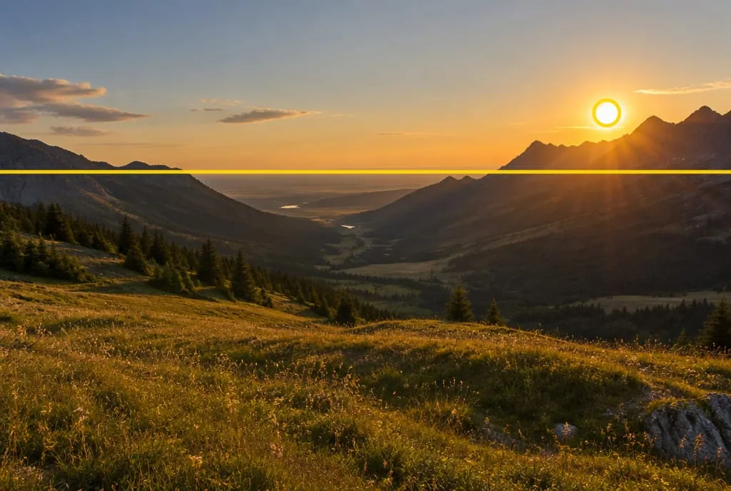 The yellow line is the flat horizon used to calculate sunset time; the ridge on the right sits far above it, so the sun reaches the ridge first. Generated image to illustrate the concept, not a shot of a real place.
That’s why 3D terrain or augmented reality has real value. Among the testimonials on the PhotoPills site is one that praises exactly this: telling you when the Sun or Moon will rise over a distant mountain as seen from a specific spot. It’s one user’s opinion, not a measurement. The point holds for any tool, though: a map without terrain gives you the direction, not how high the obstacle reaches.
A free check you can do on site is the outstretched fist: it covers about 10° of sky (the rule astronomers use, reported by EarthSky), so it gives you a feel for how far the ridge rises above the horizon. We cover it in the golden hour guide.
How do you choose based on what you need to do?
Start from the task, not the app. This table only uses features stated on the official pages or by Shotkit.
| If you need to… | Try first | Why |
|---|---|---|
| Know in 2 minutes where the sun sets at a spot | SunCalc or The Photographer’s Ephemeris web app | Map, direction and times with nothing to install |
| Scout a spot and see the sun’s path over the real landscape | PhotoPills, Sun Seeker or The Photographer’s Ephemeris on iOS | Augmented reality through the phone camera |
| Understand how light falls on mountains and valleys | The Photographer’s Ephemeris with 3D view | The official page describes a 3D map lit by realistic directional light and shadows |
| Plan the Moon and the Milky Way too | PhotoPills or The Photographer’s Ephemeris | Both cover night and rare alignments |
| Use Android only | PhotoPills, Sun Seeker or the web tools | Helios and Lumos are iOS-only |
If you can’t decide, pick a free web tool and use it for three outings. It’s the cheapest way to find out which features you actually need.
Where does Framia’s AI Planning fit in?
It doesn’t replace a sun-on-map calculator: it works alongside one. On Framia, AI Planning starts from what you want to shoot, where and when, and builds a plan with light times, weather, gear, compositions, shooting spots and a checklist, which you can export as a PDF to read offline. It’s a subscription feature and uses credits.
For the exact sun direction at a spot with a mountain in front of it, it still makes sense to check with one of the tools above: that’s what they’re built for. The plan helps you assemble the rest, from choosing the subject to a plan B for overcast skies. If you want a paper template, there’s a downloadable planner inside the article on planning a photo outing.
What to do next: the 20-minute test
Do this with a place you know and a free tool. You don’t need anything else.
- Pick a spot near you with a horizon that isn’t flat: a hill, a row of buildings, a wood.
- Choose an evening with a clear sky. Open SunCalc or The Photographer’s Ephemeris web app, set the place and Saturday’s date, and read the listed sunset time.
- Move the time slider and watch where the sun’s line falls on the map: note which side of the scene it will set on.
- Get to the spot about 30 minutes before that time. Note when the sun disappears behind the obstacle: if the horizon isn’t flat, it will be earlier than the tool’s time.
- Take one photo at the predicted moment and one at the real one: compare the light and the direction of the shadows.
- Write one line: “here I lose the sun X minutes before the listed sunset”. Next time you’ll start with a correction of your own, not an abstract number.
Once the sun has dropped behind the obstacle, the evening isn’t over: see how to work with the sky that’s left in blue hour photography with less noise. For tools that help after the shot rather than before it, read apps to improve your photography.
FAQ
What is the best free app to plan light?
For the basics, a web tool: SunCalc shows the sun's path on a map, and The Photographer's Ephemeris offers a web app you can start for free. There is no single best app: it depends on your phone and on how much you want to do in the field. Use the table by need in this article to decide.
Is PhotoPills worth the price?
It depends on what you plan. According to its official site it costs $10.99 and bundles a planner, augmented reality, and exposure and depth-of-field calculators. An independent guide notes that many people won't use every feature. If you only need sun direction and times for sunrise and sunset, a free tool may be enough; if you also plan the Moon and the Milky Way, it makes more sense.
Are sun-position apps accurate?
They calculate the sun's geometry for a place and a date, and on that they are reliable. The differences you see in the field come from the real horizon, which is rarely flat, and from the weather, which these apps don't predict. Augmented-reality compasses vary more: an independent guide reports users having to recalibrate Sun Seeker.
Can I plan for a date months away?
Yes, the sun can be calculated for any date. The Photographer's Ephemeris says on its site that you can pick past, present and future dates, from a trip tomorrow to one ten years from now. Weather is different: it's only reliable a few days out.
Can I skip the apps altogether?
To recognize low light, yes: your shadow and your fist are enough, as we explain in the golden hour guide. An app earns its place when you need to know in advance from which side and at what time the sun will reach a specific spot, especially somewhere you've never been.